Guest Post by Willis Eschenbach
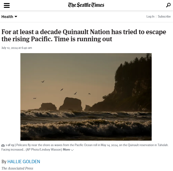
The Seattle Times, in its usual alarmist fashion, has an article about how the dreaded “rising seas” are forcing the Quinault Nation to move its main town, Taholah.
Seeing that, I decided to take an overview of the claims about Taholah. A Google search for “Taholah rising seas” finds over eighty media claims that “rising seas” are threatening Taholah. Searching “Taholah climate change” finds a bunch more. A Bing search for “Taholah” and “rising seas” yields no less than 1,830 articles. And they’re all singing from the same hymnbook, going on about seawater incursions into the town and raving about how rising sea levels are the cause … but not one of them has taken the time to investigate the facts.
Here’s an overview of where Taholah is located, on the Olympic Peninsula up near the Canadian border, about as far north as Seattle.

Figure 1. Overview of the location of the main town of the Quinault Nation, Taholah
Let me start with the important question. Do the good folks of the Quinault Nation need to move their largest town?
Yes, absolutely they do, but not because of climate change or rising sea levels.
The real reason they need to move? Because when, not if but when the next tsunami comes, it will wipe them off the map. Most of the town is less than sixteen feet (five meters) above sea level.
And curiously, the geological forces that create the tsunamis also mean that the sea level at Taholah isn’t even rising … I’ll return to that in a bit. First, let’s delve into the tsunamis.
Geological evidence shows that the Cascadia Subduction Zone (CSZ), which runs from Northern California to Vancouver Island, Canada, produces large tsunamis that threaten the coasts of Washington, Oregon, British Columbia, and Northern California every four hundred to five hundred years on average. And it’s been a while since the last big one in 1700… we’re coming due. That’s why I said when the tsunami comes, and not if the tsunami comes. It is inevitable. A NOAA article on the question says:
“It has been over 300 years since the 1700 event. In this time, stress has been building between the plates. Evidence suggests it may not be too long before the next great earthquake shakes the region.
We do not know when that will happen. It could be tomorrow, or it could be many years from now.
It could be a magnitude 9.0 “full rip” or a partial rupture (magnitude 8+). Either would have significant impacts.”
Seems to me like a more than adequate reason to move Taholah to higher ground right there, no need for further excuses …
So what is the connection between tsunamis and sea levels? Well, the CSZ is where the Juan de Fuca, Explorer, and Gorda tectonic plates subduct beneath the North American plate. The plates colliding are what creates the earthquakes that generate these monster tsunamis.
And in that ongoing slow collision between plates, the North American plate is continually being forced upwards fast enough that at some Pacific Northwest coastal locations, sea levels are actually falling. Here are the local NOAA tidal stations. Blue arrows show where the sea levels are falling.

Figure 2. Nearest NOAA tidal stations to the Quinault Nation town of Taholah.
Note that of the three stations nearest to Taholah on the coast, two of them show falling sea levels and one shows a rising sea level … here’s the rising sea level at the first station south of Taholah.

Figure 3. NOAA sea level trend, Toke Point, Washington
Now, there’s something interesting about this record. The uncertainty (± 0.71 mm/year) is larger than the trend (0.43 mm/year). And when that happens, statistically we cannot even say whether the sea level is rising or falling—it could be either one.
Next, here’s the falling sea level from Astoria, Oregon, the next tide station south of Toke Point.

Figure 4. NOAA sea level trends, Astoria, Oregon
This record, although it is much longer than the Toke Point record above, shows the same thing—the uncertainty is greater than the trend. So once again, statistically we can’t say if the sea level is rising or falling in Astoria.
We can say, however, that it is highly unlikely (~2.5% chance) that the sea level is rising more than the trend plus the uncertainty, which is 0.15 mm per year. That highly unlikely occurrence is about 15 mm (0.6 inches) per century … be still, my beating heart …
Finally, here’s the Neah Bay record from up at the north tip of the Olympic Peninsula.

Figure 5. NOAA sea level trends, Neah Bay, Washington
Here, the uncertainty is far smaller than the trend, so statistically, we can say that the sea level around Neah Bay is falling due to the land being forced upwards faster than the global rise in sea level.
So given that the sea level isn’t rising around Taholah, why is Taholah seeing water incursions into town?
It’s because they built the town on unconsolidated estuarine silt and soil in the Quinault River delta … and as such soils inevitably do over time, they are compacting and sinking, and taking the town down with them. This is indeed tragic, but it has exactly zero to do with sea level rise.

Figure 6. Closeup of Taholah and the Quinault River delta.
To summarize: South of Taholah, there’s no statistically significant sea level rise or fall, and north of Taholah, the sea level is falling.
This, of course, all means that the dozens and dozens and dozens of articles claiming that Taholah is endangered by rising sea levels are … well … let me call them “ludicrously misinformed” and leave it at that.
And the conclusion from this?
You absolutely cannot trust the modern media to do even the simplest verification of factual claims. And you can’t believe them even if they agree with each other—the media consensus is as meaningless as the so-called “scientific consensus”. Here we have over a hundred articles by various print, online, and tv media from all over the planet, all passionately and forcefully repeating the same easily checked falsehood.
This would have been somewhat acceptable before the internet, but it took me a total of about fifteen minutes to look up the local sea level rise and to learn that Taholah cannot possibly be endangered by sea level rise because the sea level is not rising around Taholah.
In closing, let me say that I wish the good folks of the Quinault Nation all the best in their plans to move to higher ground. Moving a whole town is not an easy thing to do, but as the saying goes, “Needs must when the devil drives” … and a giant tsunami certainly qualifies as a devil in my book.
My very best to everyone, and to all you good media folks out there … do your dang homework, because in 2024 you can be sure that if you don’t, someone else will …
w.
PS: It’s also obvious from these sea level records that there is no acceleration in the rate of sea level rise … but that’s a separate question.
My Usual: When you comment, I implore you to quote the exact words you are discussing. I’m more than happy to defend my words, but I can’t defend your interpretation of my words. Thanks.
Proving Me Wrong: If you wish to prove me wrong, here is how to do it. Hele on!








Great assessment of the situation and totally agree that had this story been investigated thoroughly they would not be able to make such unsupported claims! The media hypes and then hopes nobody will do their homework. Had they even considered the geologic implications and the measurements of actual sea level rise or fall might have had some impact on their predictions but I’m not holding my breath!